Using Satellite Data to Analyze the Initiation and Evolution of Deep Convective Clouds
CAO Zhi-Qiang1, 2, 3  , HUANG Qing-Ni
3 , ZHAO Su-Rong4
, HUANG Qing-Ni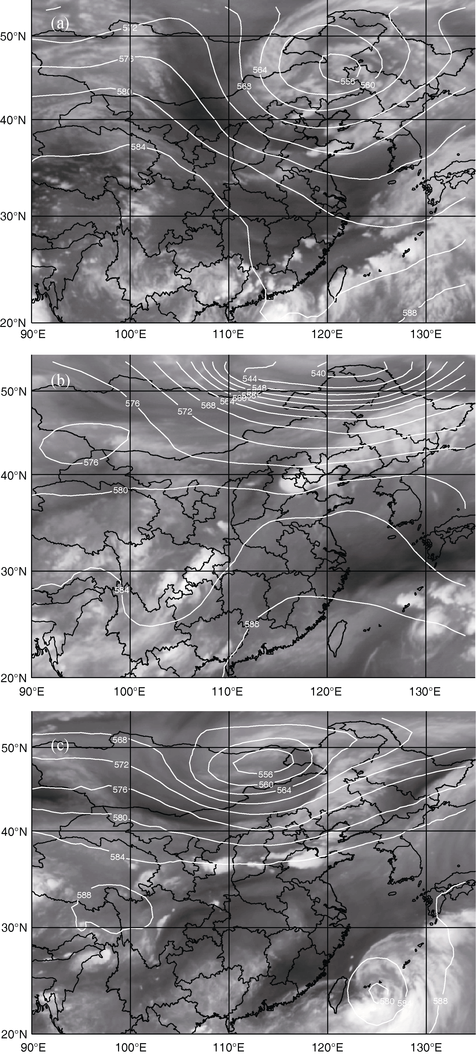
Using Satellite Data to Analyze the Initiation and Evolution of Deep Convective Clouds |
|
CAO Zhi-Qiang
, HUANG Qing-Ni |
| Figure 1 Overlaid imagery of FY geostationary satellite water vapor channel data a 14:00 BT 14 June 2005, b 8:00 BT 18 July 2007, c 2:00 BT 9 August 2010, and NCEP 500 HPa geopotential height data. |
| |