Results of a CLM4 Land Surface Simulation over China Using a Multisource Integrated Land Cover Dataset
Results of a CLM4 Land Surface Simulation over China Using a Multisource Integrated Land Cover Dataset |
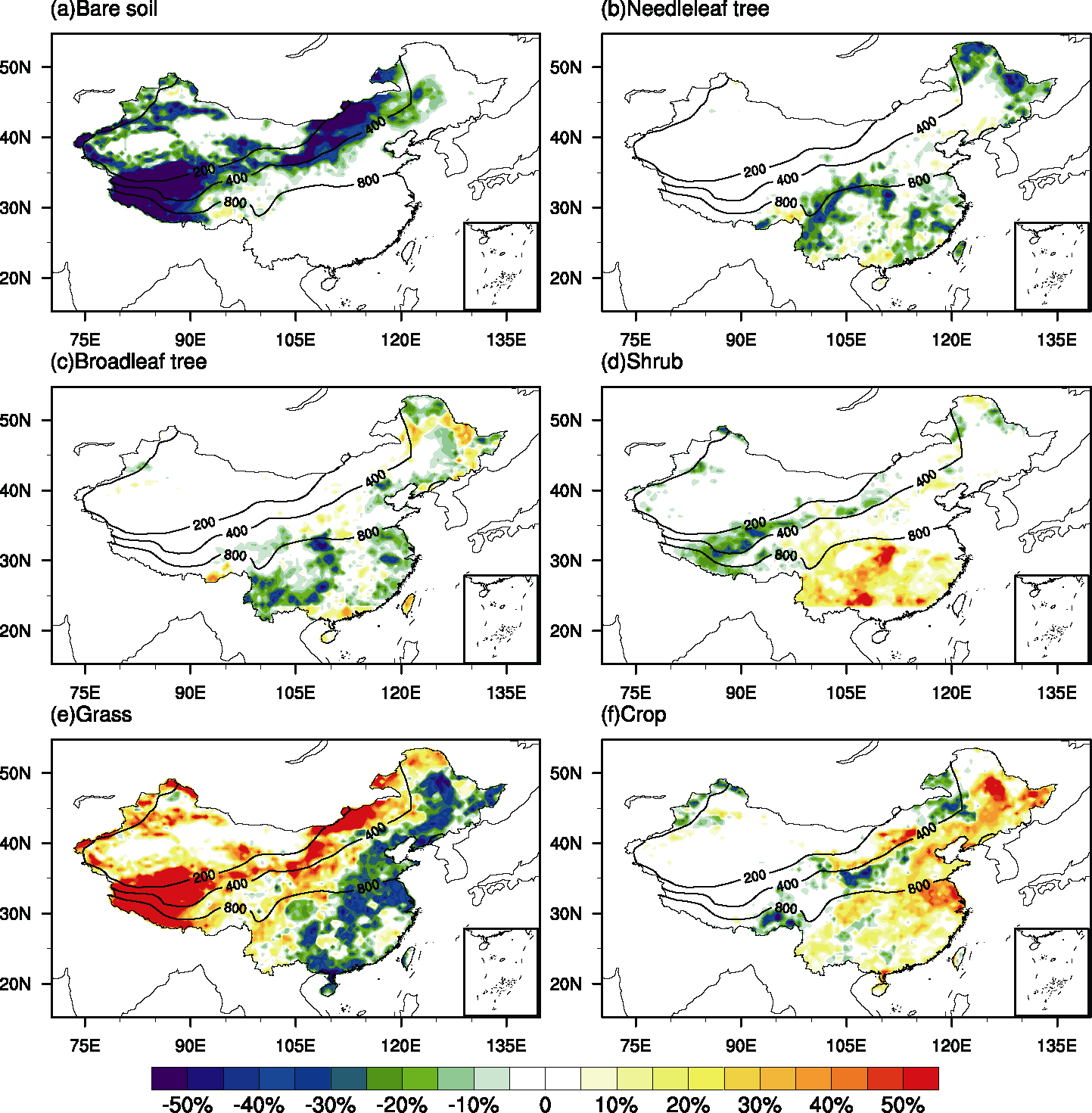
| Figure 1 Percentage differences in area of plant functional types between MICL Multisource Integrated Chinese Land cover data and MODIS MODerate resolution Imaging Spectroradiometer data in China at 0.5#cod#x000b0; grid resolution. Isolines refer to the mean annual precipitation mm yr -1 . |
| |