Application of a Coupled Land Surface-Hydrological Model to Flood Simulation in the Huaihe River Basin of China
LI Min1, 2 , LIN Zhao-Hui1, 3, *  , YANG Chuan-Guo
4 , SHAO Quan-Xi5
, YANG Chuan-Guo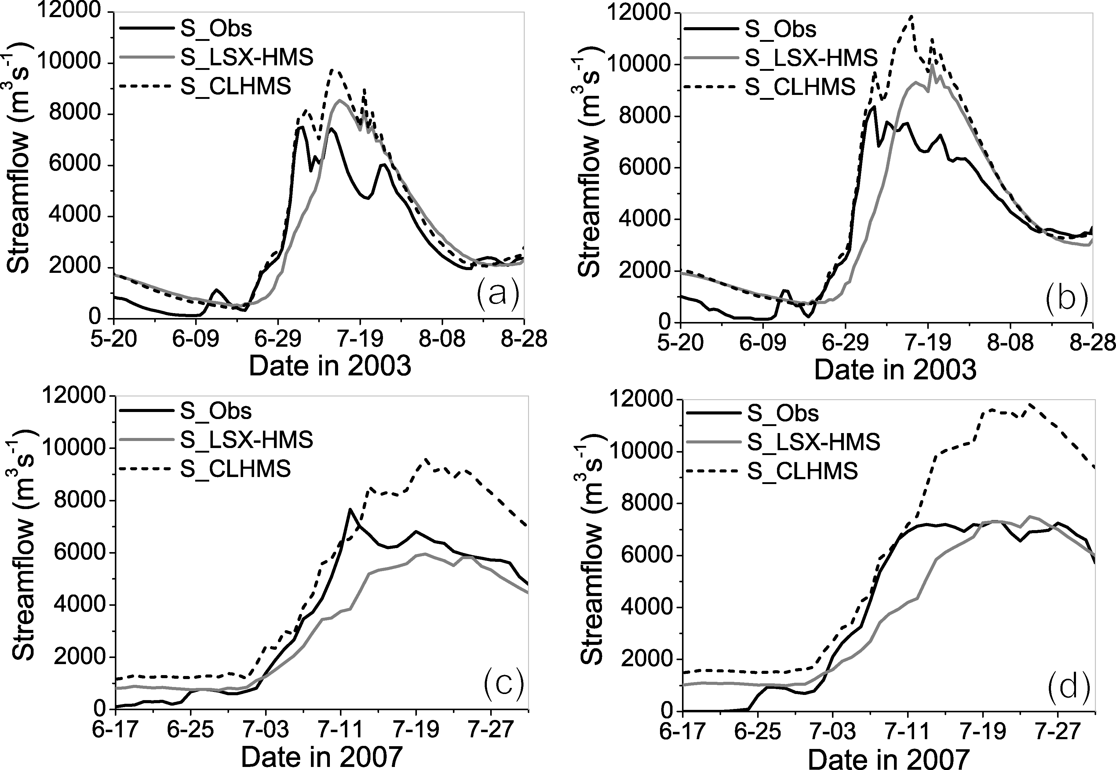
Application of a Coupled Land Surface-Hydrological Model to Flood Simulation in the Huaihe River Basin of China |
|
LI Min
, YANG Chuan-Guo |
| Figure 3 Comparison of simulated and observed streamflow at a Lutaizi station in 2003, b Bengbu station in 2003, c Lutaizi station in 2007, and d Bengbu station in 2007. The observed hydrograph is shown as a black solid line. The simulated hydrographs from the LSX-HMS and CLHMS models are shown as gray solid and black dashed lines, respectively. |
| |