The radiative climate and environmental effects of cirrus clouds is an international cutting-edge field of scientific research in the atmospheric sciences. Understanding how the characteristics of cirrus clouds over the ocean evolve is critical for comprehending the dynamics of climate change. In this respect, due to their unique regional characteristics, the cirrus clouds over the South China Sea (SCS) hold particularly significant scientific and practical value.
Recently, the Advanced Science & Technology of Space-Atmospheric Physics Group (ASAG) from the School of Atmospheric Sciences at Sun Yat-sen University, China, has published a research paper titled “Physical characteristics of convective and non-convective cirrus clouds from CALIPSO data over the South China Sea” in Atmospheric and Oceanic Science Letters (AOSL). This study, leveraging satellite-based earth observations, explores the spatiotemporal and convective characteristics of cirrus clouds over the SCS.
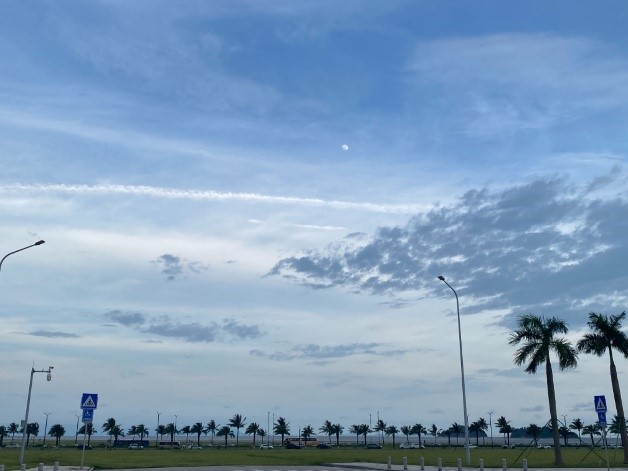
The SCS, a semi-enclosed sea situated between the Pacific and Indian oceans, plays a pivotal role in both regional and global climate systems. It is a primary source of water vapor and heat, significantly influencing weather patterns and monsoon systems in Southeast Asia. The cirrus clouds prevalent in this area are a key component of radiative climate change in the region. These clouds affect the radiation balance by reflecting incoming solar radiation and impeding outgoing infrared radiation, subsequently impacting atmospheric circulation patterns. Understanding the behavior and characteristics of cirrus clouds (Fig. 1) in the SCS is essential for enhancing weather forecasts and climate models.

Fig. 1. Cirrus clouds in the atmosphere over the South China Sea (Location: Zhuhai, China; Credit: Haorui Weng)
The SCS is a region where land, ocean, and atmosphere interact strongly. In this context, deep convective activity in this region is crucial to the formation and maintenance of cirrus clouds. However, research on the physical characteristics of convective and non-convective cirrus clouds in this region is very limited.
The study found that the formation of cirrus clouds in the tropics mainly originates from two mechanisms: in situ formation and convective formation. The former can be attributed to negative temperature disturbances caused by large-scale vertical uplift, Kelvin waves, and gravity waves, while the latter comes from deep convective activities.
To investigate this, the research team from Sun Yat-sen University analyzed convective and non-convective cirrus clouds over the SCS based on CALIPSO satellite data products, and the results were recently published in AOSL. According to this study, the number of samples of convective cirrus is three times that of non-convective cirrus. Convective cirrus show a higher ice water content and are accompanied by moist environmental conditions, while non-convective cirrus have lower ice water content. In addition, further analysis revealed that the cloud fractions of convective cirrus and non-convective cirrus show different vertical distributions, with the largest cloud fraction of convective cirrus appearing at 14 km but that of non-convective cirrus appearing at 15–16 km. Finally, the seasonal change mechanism driving the two types of cirrus cloud fractions is clarified. The seasonal change of convective cirrus cloud fractions is mainly driven by bottom-up positive specific humidity anomalies, while the non-convective cirrus clouds are driven by top-down negative temperature anomalies.
Overall, the above results enhance our understanding of the role that the temporal and spatial characteristics of cirrus clouds over the SCS play in influencing the regional radiative climate environment.
Link:
https://doi.org/10.1016/j.aosl.2024.100510
Citation:
Weng, H., Han, Y., Deng, X., Dong, L., Liu, Y., 2024. Physical characteristics of convective and non-convective cirrus clouds from CALIPSO data over the South China Sea. Atmospheric and Oceanic Science Letters, 100510. https://doi.org/10.1016/j.aosl.2024.100510.
|